Yet another beautiful sunset

Yet another beautiful sunset
Approaching Charleston last fall

Monday, November 15, 2010

Useppa Island SM 23 to Sarasota, FL SM 74


November 12, Friday:

On the right: Light house at the entrance to Mystic River, CT


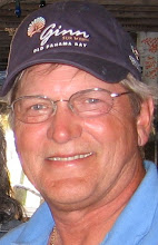
At left, yours truly with three "Nuns", they were a team in the 5 legged relay(Downhill skiing, 10 mile cross country ski, 26 mile bike, 6 mile run, 2 mile kayak and 1/2 mile sprint, in Bend Oregon last winter. The team name The 3 Bad Habits, from left to right were Tequila, Chocolate, and Caffeine. Of course this has nothing to do with the cruise, but I threw it in just for fun.

We had some boisterous winds starting out today. Rose at dawn and were underway by 7:30. Winds were northeast at 15-20. We were planning on an outside passage to be able to sail on the last day of our cruise. A few miles in we had to decide if it was going to be to tough a slog up wind outside. After checking the bridges ahead we found 9, most of which would open on request, but added to that it was a slow and twisted channel in many spots. So we elected to go out Boca Grande Inlet stay close to shore where the wind wouldn't have much fetch to build up the chop. This worked out very nicely and the soundings dropped off to 20 feet just a hundred yards off the beach. The wind abated to around 15 with occasional higher gusts and we raised main and genoa and sailed most of the way close hauled or nearly so making 6 knots.
I kept reminding Jason to stay close to the beach. He asked, "How close should I get?"
To which I replied, "You'll know your close enough when you can tell if the gals are wearing a one or two piece bathing suit!" Ahhh......the fringe benefits of Florida sailing. We got so close to the Venice Pier that we were waving at the fisherman and tourists.
As we scoped out the two inlets to Sarasota, the information available was conflicting and worrisome. Most shifting shoal inlets are not charted on the East Coast and state that on the chart, although they do in fact have nav markers, these markers are constantly moving and can't therefore be fixed on the chart.
Both Big Pass and New Pass into Sarasota Bay show markers on the chart, however, the Sarasota Sailing Squadron web site shows that New Pass is shoaled in and not recommended. Furthermore, that Big Pass has been remarked and not as shown on the current charts. We elected to use Big Pass and to sound our way in with the centerboard most of the way up. As it turned out we were able to follow several other power boats in that showed us the way. Plus the water was clear enough to be able to see the most dangerous shoals. At near high tide our lowest sounding was 9 feet. The balance of the channel inside the inlet was narrow and even more shallow, with visible above water sand bars only a few yards from us in several areas.
We arrived at the Sarasota Sailing Squadron dock at 4PM, lots of friendly folks to show us the transient dock and help us tie up bow in and between pilings.
So arrived at last after 39 days and 1728 nautical miles!
Jason flew back Saturday AM. Thanks Jason for being a very competent crew a huge help and great company.
I have found a very reasonable dock a few miles north in Sara Bay for a couple of months in front of a private home, while I wait for the mooring I purchased to become available at the Sarasota Sailing Squadron. I am flying back home Tuesday to see my lovely bride.
So long for now, until the next adventure. Could be Cuba this winter.


LaBelle OWW SM103 to SM 150 then toUseppa Is ICW SM 23


November 11, Thursday:


At left, a little summer cottage with some southern charm.
Covered 70 statute miles today including 47 on the Okeechobee Water Way and 23 on the West Coast ICW which restarts at 0 SM at the Fort Myers exit of the OWW. Winds were north east at around 10-15 and we were able to motor sail in the waterway most of the way. Starting out heading south west until we exited at Fort Meyers then North West. This is pretty section of the waterway with lots of waterfront homes. In Coral Gables there are lots of canals with waterfront homes able to keep their boats right in their back yard.

We finally found a marina, the Fort Meyers Yacht Basin, with diesel and so we fueled up topped off water etc. For 5 bucks we were able to use the shower facilities. They even had some cold beer, which we were running low on (whew, close call).

After passing thru what is termed the miserable mile ( due to the extremely narrow channel shallow water everywhere and lots of traffic) we were able to head north (a novelty).

As we passed Captiva Pass the sun was setting and we slowed down to be able to see the sun set over the ocean (and potentially see the mystical green flash, rarely visible as the sun takes it last dip over the horizon) it was a very nice sunset, but alas not green flash this time.

We arrived at Useppa Island, which is only a few miles from Boca Grande Inlet, at the mouth of Port Charlotte. Our anchoring guide only covers the East Coast so we were on our own picking out a good anchorage. As it turns out we must of picked well as there were 6 other boats already anchored in the lee of the island when we arrived. We had to anchor just outside a cable area, where anchoring is not allowed, and squeezed between the channel of the ICW and the very shallow near shore. We anchored in 8 feet of water, but apparently we were so close to the shoal that in the AM our centerboard was rubbing bottom as we moved closer to shore and weighed anchor.

Port Mayaca, OWW SM 39 to LaBelle FL SM 103


November 10, Wednesday:

At left: Ponce De Leon guarding the Fountain of Youth (or so he hoped, although it didn't work for him, but lots of folks are still trying to see if it will work for them)
Today was our chance to see Lake Okeechobee. We weighed anchor at 7:45 and had to lock thru up a couple of feet to the lake level. We had anchored bow and stern just past the old railroad bridge in a wide spot in the canal. Once out in the lake we were able to raise the main and jib and motor sail in 10 knots of north west wind. The lake is pretty big with an horizon in most directions, but mostly only 10 feet deep. It was 25 miles across to the channel that cuts thru the very shallow west side of the lake. Once we were on the west side we had to follow a canal dug along the shore for about 10 miles to the Morehaven lock. It was in this section we saw quite a few alligators. Most were hanging around with their eyes and noses above water and nothing else. They typically submerged as we motored past. We did see a five footer sunning himself on the bank.
The Morehaven lock dropped us only a few inches and went very quick. We motored the last leg to LaBelle trying to find some fuel along the way. This section does not support many marinas. The first was an RV park on the canal in Morehaven which was out of business, the next was only open from 9 to 1 and then we got to one that reportedly had diesel and they were cleaning the tanks. The next one up would fuel you up from a truck. but would not bother with a 30 gallon sale for us. Fortunately we had filled up in Ft. Pierce and had 5 gallons stored on deck so we weren't desperate. The power boat we locked thru with had to dock in Morehaven to wait for fuel the next day.

LaBelle is in the interior of Florida and is very agricultural. The city dock was free, but required you to do what is called a med moor. This means dropping an anchor 100 feet or so in front of where you want to be docked stern to, and backing in. Then when you tie up on the dock you have to tension the anchor line to keep you just off the dock but able to jump off the stern to go ashore. Boats in the med that do this often have a boarding plank to make it a little less hairy disembarking.

Jason found us a nice restaurant on his Iphone only a few blocks away and we had some local fresh fish that was fantastic.

Tuesday, November 9, 2010

Jensen Beach SM 982 to Port Mayaca FL

We are now in the Okeechobee water way. After a few miles in the ICW we turned off at the St. Lucie River and reset the mileage at zero for this new waterway, with Port Mayaca at mile SM 39. There were a couple of delays on the route today. The Roosevelt Bridge showed opening on the hour and half hour so we timed our arrival accordingly only to find out it now opens on request. The current was very strongly carrying us into the bridge which was not quick enough in opening and we got sideways in the railroad bridge immediately prior to it, narrowly avoiding a good scraping.
When we got to the St. Lucie lock, we had to wait for eastbound traffic to be let down in the lock for a half an hour. The lock lifts you up 14 feet and does not have valves to let the water in or out, rather it cracks open the gate. The current was quite strong requiring some deft line handling to keep the boat in line and off the walls of the lock.
The St. Lucie river and the first few miles of the waterway were dotted with spectacular homes, some of the nicest yet. We ended the day just before the Port Mayaca Lock which lets you out into Lake Okeechobee. We anchored bow and stern in the narrow canal in a wide spot just after the notorious railroad bridge which is only 48 foot clearance for masts, while in the up position. This prevents many boats from being to use this waterway. Some clever guy will put 55 gal plastic drums aboard on one side and pump them full of water to heel the boat enough to allow boats with up to 53 foot masts to squeak thru. As we only need 41 feet it was not a problem, but still looked very close as we slowly passed under.

Fort Pierce SM 965 to Jensen Beach FL M 982


November 8, Monday:


Lingered at Aunt Lou and Uncle Mike's to help with his computer connection and the garden.

Did some grocery shopping since we had use of the car.
This pic is the Lighthouse at St. Augustine from our anchorage the second night. Again a little our of sequence

Had lunch in downtown Ft. Pierce at the Tiki Restaurant, and finally got underway from the Harbortown Marina at 2pm. Little problem leaving the dock. We had the dingy trailing astern and the wind blew it behind a dolphin. As we made a decent exit and started forward the dingy hung up on the dolphin and the painter parted with a big bang. This occasioned us to have to return to the dock to retrieve the dink. This was a bit of a hash as there was a cross wind and the dock set up was between pairs of dolphins. So with a little help from a friendly fella on the dock, we were able to temporarily able to dock while Jason dashed off to get the dingy which was slowly drifting under the dock and getting to be quite a challenge to get at. With some quick foot work, Jason was able to snag the dink and jump in.

The second departure was a bit more controlled as we slowly backed out and used one of the dolphins to let the wind pivot us in line with the exit channel. The day turned out great as the clouds blew south and we motor sailed 17 miles to Jensen Beach. We found a great anchorage just downwind of the causeway bridge and after dinner aboard, dingyed over to Conchy Joe's for a few beers and Monday Nite Football. Great spot with free snacks and good beer.

Sunday, November 7, 2010

Catching up on some Pics along the way

Mystic Seaport, cat boat taking sightseers for 1/2 sail in Mystic River
Mystic Seaport, with authentic old schooner near

and Kia Ora (semi authentic old schooner) way way in the back ground anchored.

Classy waterfront on the ICW on the way from St. Augustine to Daytona


The Grandfather of all clocks, in the entrance to the Lintner Museum


Courtyard of the Lintner Museum, with coy pond


in foreground, former Grand Hotel, St. Augustine


Charleston waterfront homes


Skyline of Manhattan


Tall Ship in the East River


Melbourne FL: SM 918 to Fort Pierce, FL SM 965

This is just east of Boothbay Harbor, Maine. I'm just getting the hang of adding pictures to the blog so I'm catching up on some of the highlights in my photo album. So this is way out of sequence. Laurel (number 1 daughter) and I sailed up there last September.
November 7, Sunday:
My post yesterday was a little premature. When we got the the Ponce de Leon Inlet the weather forecast showed winds to 25 from directly astern, which heaped up waves to 11 feet. With the hurricane Thomas potentially kicking them up even more we elected to stay in the intracoastal. This allowed us to stop at Melbourne where my best buddy from Garden City High School lives. We recently reconnected via Facebook. We got together for a great night of reminiscing and catching up for the over 40 years since we have seen each other. Thank you Steve and Claire for putting me up in a warm and comfortable bed. It was pretty cool last night. Jason connected with his Aunt who lives 15 miles north in Cocoa Beach and stayed with them.
We were able to tie up to the Melbourne Yacht Club gratis thanks to member Hasty Miller who extended the invitation.
We are motor sailing with just the jib again today, as the winds are directly astern at 20 knots just like yesterday. We should arrive in Ft. Pierce at around 4PM today and we will stay with my Aunt Lou and Uncle Mike who live nearby.